As part of my second year of MSci Geology at University College London, I gained the opportunity to go on a one week field trip to Pembrokeshire, Wales. Throughout 5 days I visited the scenic coastlines and headlands of southwest Wales to witness ~300 Ma of UK's geological history. I observed the past volcanic activity, two plate tectonic cycles followed by folding and faulting caused by mountain building, seen to be caused across Europe. I unfolded a story that began in the Precambrian and climaxed towards the end of the Carboniferous period.
- Day 1: 10/04/2022
- Location: Broad Haven (SM 8606 1358)
- Weather: cloudy, cool
- Hazards: slippery rocks, rising tide, unstable cliff face
- Mood: energetic
Broad Haven was only a few minutes walk away from the youth hostel, in which I dwelt for the week. I aimed to accomplish 3 things at this location. To make a quick field sketch, record the lithological descriptions and interpret the geological history. I observed many layers of interbedded sandstone and shale. This indicates a change in environment; sandstone and shale indicating high and low energy environments respectively. These changes correlate to climate and sea level variability. Through the middle section of the main outcrop the majority of the shale was at the bottom, while the sandstone was at the top, suggesting marine regression and a relatively deep marine environment. Walking westwards along the outcrop I spotted overturned beds. Sandstones were the wrong way up. Evidence for this is seen in the sandstone's cross bedding. Further west, above the sandstone bed, I found a coal seam, which is followed by another sandstone bed. The presence of coal helps identify that I was near the Upper Carboniferous in the stratigraphic column. Coal hints at the past presence of plants, therefore, implying a terrestrial environment. This environment, in turn, hints at further marine regression. The sandstone bed that follows after the coal seam in the stratigraphic column means that later marine transgression had occurred. By walking east from the main outcrop I saw major folding and some thrust faults, which indicate tectonic compression. This relates to the Variscan orogeny showing a north-south trend.
 |
Red Mudstone at
Freshwater West |
- Day 2: 11/04/2022
- Location: Freshwater West (SM 8819 0001)
- Weather: extremely windy, cloudy
- Hazards: slippery rocks, strong wind
- Mood: tired
On the second day I took a one hour bus ride to Freshwater West, the place where Dobby died in the 'Harry Potter' franchise. My two main aims were to make lithological descriptions of the rocks I would find and construct a stratigraphic log of the beach area. I began the stratigraphic log from the mudstones of the late Silurian, all the way down, at the southern end of the beach, to the Old Red Sandstone (ORS) of the Devonian. The ORS preserves excellent sedimentary features, as well as a diagenetic overprint, which reveals the depositional environment of the rocks. About 500 metres from the starting point (parking area of the beach), I spotted a dextral strike-slip fault with a displacement of over 100 metres. This fault dissects the wave-cut platform and is another piece of evidence for the Variscan tectonics, that were seen in Bude Haven.
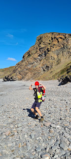
- Day 3: 12/04/2022
- Location: West Angle Bay (SM 8524 0322)
- Weather: cloudy, gentle wind
- Hazards: tide, slippery rocks
- Mood: excited
 |
| A bird's eye view map of West Angle bay |
Upon my arrival at West Angle Bay I aligned my map of this locality in the correct orientation. I used this location as an area to hone my skills in geological mapping by recording structural measurements and identifying lithologies and their borders. I observed many structures: ripple marks, planar laminations, calcite veins, herringbone bedding, gulleys. I also spotted fossils, mainly, crinoids and echinoids. Other structures that I saw served as great way-up indicators: bioturbation and cross-bedding. Chert nodules were also present. Their presence can be explained in 2 ways. One, they precipitated from silica-rich seawater that percolated from deep sea hydrothermal vents. Two, the nodules precipitated from detrital sediments during diagenesis. Before I left the location I noted down a short structural summary of the area. The gulleys, between the rock, were created by the presence of faults. Faults create a lot of fractures, which weaken the rock and the water rushes in. The gulley that was closest to the beach area contained a sinistral fault. The orientation of veins was north-south (sigma 1 stress direction). Therefore, the veins opened along east-west (sigma 3 direction). Further west, away from the beach, there is a big thrust fault along the dark shale/limestone rock. Parallel to the bedding from the first sand pit (smallest) to the second sand pit (further west from the 1st one). The thrust fault has a very low angle. I also observed styolites (en echelon gash arrays), which also indicated the aforementioned stress orientation to be north-south.
 |
| A gulley at West Angle Bay |
- Day 4: 13/04/2022
- Location: Amroth (SM 1674 0714)
- Weather: misty, cloudy, no rain
- Hazards: tide, slippery rocks
- Mood: ok
On day 4 I took a bus ride to Amroth. After parking I made my way to the beach and walked along it until i found the cliff face I wanted to analyse. Amroth marks the northeastwards extent of Variscan deformation. This can be seen on the east and west side of the beach. On the west side of the beach I spotted coal seams from the late Carboniferous, which I also observed in Broad Haven. Just as in Broad Haven, the cliffs at Amroth expose folds and faults. Two of the three folds can be described as whaleback folds. The third is a standard anticline. The limestone rocks within the cliff contain Calamite fossils, a carboniferous tree. These Calamites are preserved in growth position. Their presence implies a terrestrial depositional environment.
.jpg) |
| Amroth beach |
- Day 5: 14/04/2022
- Location: Marloes Sands (SM 7860 0716)
- Weather: cloudy, gentle breeze
- Hazards: fast incoming tide, slippery rocks
- Mood: happy
 |
Vertical beds of sandstones at
Marloes Sands |
The beach at Marloes Sands reveals strata representative of the entire Silurian succession in Pembrokeshire. The succession contains many faults, which obscure the startigraphic contacts between the four rock units that are exposed at this locality. Those 4 units include: the late Silurian Old Red Sandstone, early Silurian Skomer Volcanic Group, middle Silurian Coralliferous Group and the Gray Sandstone Group. To the east side of the beach I observed spectacular near vertical beds of alternating Gray Sandstone and Old Red Sandstone. This was the final day of my field trip at Pembrokeshire, where I did not opt to engage in research, but rather to enjoy the day at that beautiful location.
Pembrokeshire is a wonderful place and provides a fantastic opportunity for aspiring geologists to study it's geological history. Aside from geological research, it is a lovely place to go on holidays or during weekends. The scenery you will see is tremendously delightful.

.jpg)


.jpg)

Comments
Post a Comment